Halstead的类别
汽車維修Crop GrowerSocial Services Organization宗教教會Building Construction ContractorContractorInterior Construction ContractorResidential Building住房建設Education Center教育Entertainment Provider餐廳Investment Company非同步傳輸模式Cemetery內科醫生和外科醫生Hair Salon理髮師美容院Business to Business ServiceServices for IndustryReal Estate Agency公園
產業領域
Halstead按行业的企业分布
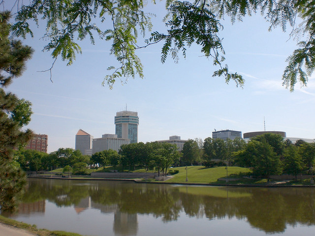
Halstead的地圖
互動地圖
Halstead的人口
1975年至2030年
| Data | 1975 | 1990 | 2000 | 2015 | 2020 | 2025* | 2030* |
|---|---|---|---|---|---|---|---|
| 人口 | 1,486 | 1,705 | 1,917 | 2,043 | 1,937 | 1,987 | 2,044 |
| 人口密度 | 1,080.3 / mi² | 1,239.6 / mi² | 1,393.7 / mi² | 1,485.3 / mi² | 1,408.2 / mi² | 1,444.6 / mi² | 1,486 / mi² |
* 预测
来源: JRC (European Commission's Joint Research Centre) 工作于 GHS built-up gridHalstead从2000年到2020年的人口变化
从2000年到2020年增长了1%
| 位置 | 自1975以来的变化 | 自1990以来的变化 | 自2000以来的变化 |
|---|---|---|---|
| Halstead | +30.3% | +13.6% | +1% |
| 干沙州 | — | — | — |
| 美國 | — | — | — |
来源: JRC (European Commission's Joint Research Centre) 工作于 GHS built-up grid
Halstead的中位年龄
中位年龄:37.2岁
| 位置 | 年齡中位數 | 中位年齡(女) | 中位年齡(男) |
|---|---|---|---|
| Halstead | 37.2 yrs | 39.4 yrs | 35.5 yrs |
| 干沙州 | 36 yrs | 37.4 yrs | 34.7 yrs |
| 美國 | 37.4 yrs | 38.7 yrs | 36.1 yrs |
来源: CIESIN (Center for International Earth Science Information Network)
Halstead的人口密度
人口密度:1,408 / mi²
| 位置 | 人口 | 區 | 密度 |
|---|---|---|---|
| Halstead | 1,937 | 1.375 sq mi | 1,408 / mi² |
| 干沙州 | 2.9 million | 82,278.3 sq mi | 35.4 / mi² |
| 美國 | 321.6 million | 3,796,740.8 sq mi | 84.7 / mi² |
来源: JRC (European Commission's Joint Research Centre) 工作于 GHS built-up grid
Halstead的历史和预测人口
从200到2100的估计人口
来源:
- JRC (European Commission's Joint Research Centre) 工作于 GHS built-up grid
- CIESIN (Center for International Earth Science Information Network)
- [鏈接] Klein Goldewijk, K., Beusen, A., Doelman, J., and Stehfest, E.: Anthropogenic land use estimates for the Holocene – HYDE 3.2, Earth Syst. Sci. Data, 9, 927–953, https://doi.org/10.5194/essd-9-927-2017, 2017.
价格分布
Halstead企業(按價格分佈)
人類發展指數(HDI)
預期壽命,教育程度和人均收入的統計綜合指數。
来源: [鏈接] Kummu, M., Taka, M. &Guillaume, J. Gridded global datasets for Gross Domestic Product and Human Development Index over 1990–2015. Sci Data 5, 180004 (2018) doi:10.1038/sdata.2018.4
Halstead的CO2排放
每年人均二氧化碳(CO2)排放量(噸)
| 位置 | 二氧化碳排放量 | 人均二氧化碳排放量 | 二氧化碳排放強度 |
|---|---|---|---|
| Halstead | 41,385 tn | 21.37 tn | 30,087.5 tons/mi² |
| 干沙州 | 60,730,954 tn | 20.82 tn | 738.1 tons/mi² |
| 美國 | 5,664,619,810 tn | 17.62 tn | 1,492 tons/mi² |
来源: [鏈接] Moran, D., Kanemoto K; Jiborn, M., Wood, R., Többen, J., and Seto, K.C. (2018) Carbon footprints of 13,000 cities. Environmental Research Letters DOI: 10.1088/1748-9326/aac72a
Halstead的CO2排放
| 2013年CO2排放量(吨/年) | 41,385 tn |
| 2013年人均CO2排放量(吨/年) | 21.37 tn |
| 2013年CO2排放强度(吨/mi²/年) | 30,087.5 tons/mi² |
自然災害風險
相對風險(滿分10分)
| 危险 | 风险级别 |
|---|---|
| 乾旱 | 中等 (5.7) |
*風險可能並不涉及整個地區,尤其是洪水或山體滑坡。
来源:
- Dilley, M., R.S. Chen, U. Deichmann, A.L. Lerner-Lam, M. Arnold, J. Agwe, P. Buys, O. Kjekstad, B. Lyon, and G. Yetman. 2005. Natural Disaster Hotspots: A Global Risk Analysis. Washington, D.C.: World Bank. https://doi.org/10.1596/0-8213-5930-4.
- Center for Hazards and Risk Research - CHRR - Columbia University, Center for International Earth Science Information Network - CIESIN - Columbia University, and International Research Institute for Climate and Society - IRI - Columbia University. 2005. Global Drought Hazard Frequency and Distribution. Palisades, NY: NASA Socioeconomic Data and Applications Center (SEDAC). https://doi.org/10.7927/H4VX0DFT.
最近的附近地震
幅度3.0以上
| 日▼ | 時間↕ | Magnitude↕ | Distance↕ | 深度↕ | 位置↕ | 鏈接 |
|---|---|---|---|---|---|---|
| 8/18/19 | 8:45 AM | 4.1 | 43.6 km | 5,000 m | 5km WSW of South Hutchinson, Kansas | usgs.gov |
| 8/17/19 | 1:03 AM | 3 | 39.2 km | 5,000 m | 1km WSW of South Hutchinson, Kansas | usgs.gov |
| 8/16/19 | 1:10 PM | 3.1 | 49.6 km | 5,000 m | 11km W of South Hutchinson, Kansas | usgs.gov |
| 8/16/19 | 12:59 PM | 4.2 | 42.1 km | 5,000 m | 4km WSW of South Hutchinson, Kansas | usgs.gov |
| 7/30/19 | 9:30 AM | 3.5 | 87.9 km | 5,000 m | 15km S of Solomon, Kansas | usgs.gov |
| 7/30/19 | 9:29 AM | 3.1 | 97.3 km | 5,000 m | 9km WSW of Solomon, Kansas | usgs.gov |
| 11/30/18 | 11:56 PM | 3.2 | 82.4 km | 5,800 m | 9km NNE of Harper, Kansas | usgs.gov |
| 10/3/18 | 7:36 AM | 3.5 | 81.6 km | 5,000 m | 10km NNE of Harper, Kansas | usgs.gov |
| 10/1/18 | 12:33 AM | 3 | 91.3 km | 6,470 m | 11km SW of Wellington, Kansas | usgs.gov |
| 9/13/18 | 7:43 AM | 3.1 | 84.2 km | 5,300 m | 7km NE of Harper, Kansas | usgs.gov |

關於我們的數據
本页面上的数据是使用许多公开可用的工具和资源估算的。它不附带任何担保,可能包含不准确之处。使用风险自负。